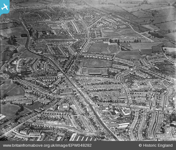
EPW048282 ENGLAND (1935). The Memorial Stadium and the surrounding residential area, Horfield, 1935
© Copyright OpenStreetMap contributors and licensed by the OpenStreetMap Foundation. 2024. Cartography is licensed as CC BY-SA.
Nearby Images (4)
EPW048282

EPW048280

EPW048281

EPW048279

Details
| Title | [EPW048282] The Memorial Stadium and the surrounding residential area, Horfield, 1935 |
| Reference | EPW048282 |
| Date | July-1935 |
| Link | |
| Place name | HORFIELD |
| Parish | |
| District | |
| Country | ENGLAND |
| Easting / Northing | 359588, 176559 |
| Longitude / Latitude | -2.5820790551518, 51.486051388468 |
| National Grid Reference | ST596766 |
Pins
 |
 Class31 |
Tuesday 14th of April 2015 02:39:27 PM |
Class31 |
Tuesday 14th of April 2015 02:38:32 PM | |
Class31 |
Tuesday 14th of April 2015 02:38:01 PM | |
Class31 |
Tuesday 14th of April 2015 02:36:32 PM | |
Class31 |
Tuesday 14th of April 2015 02:35:46 PM | |
Class31 |
Tuesday 14th of April 2015 02:34:56 PM | |
 MrNCWilson |
Monday 18th of November 2013 07:28:11 PM |