
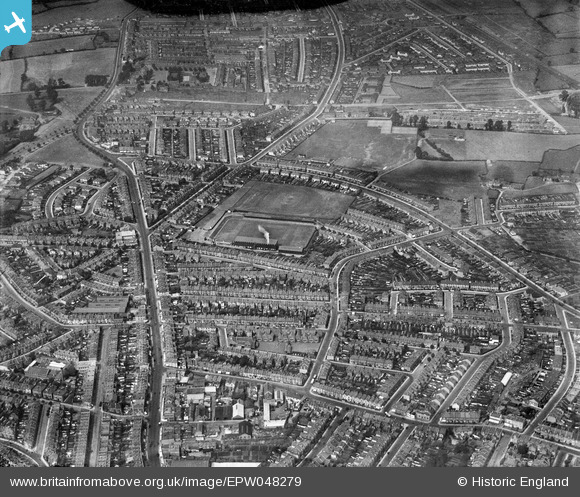
EPW048279 ENGLAND (1935). The Memorial Stadium and the surrounding residential area, Horfield, 1935
© Copyright OpenStreetMap contributors and licensed by the OpenStreetMap Foundation. 2025. Cartography is licensed as CC BY-SA.
Nearby Images (4)
EPW048279

EPW048282

EPW048280

EPW048281

Details
| Title | [EPW048279] The Memorial Stadium and the surrounding residential area, Horfield, 1935 |
| Reference | EPW048279 |
| Date | July-1935 |
| Link | |
| Place name | HORFIELD |
| Parish | |
| District | |
| Country | ENGLAND |
| Easting / Northing | 359637, 176500 |
| Longitude / Latitude | -2.5813665700715, 51.485524357076 |
| National Grid Reference | ST596765 |
Pins
 Huw |
Sunday 25th of February 2024 12:01:30 AM | |
 Class31 |
Tuesday 14th of April 2015 02:33:00 PM | |
JenB |
Saturday 11th of January 2014 09:48:19 AM | |
MrNCWilson |
Monday 18th of November 2013 07:29:14 PM |
