
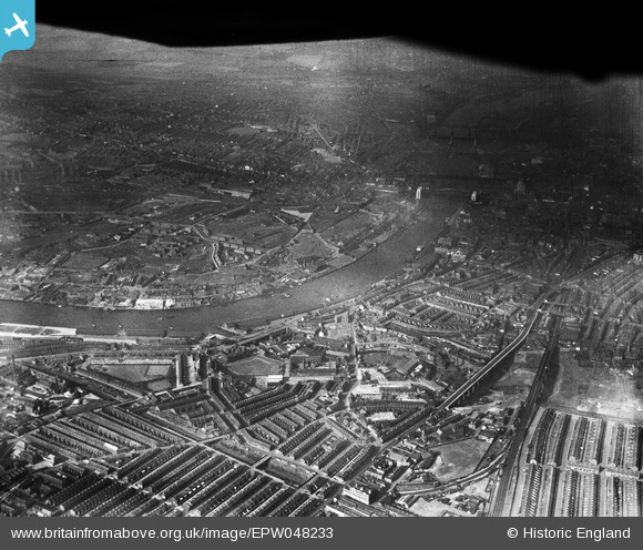
EPW048233 ENGLAND (1935). Salt Meadows and the Quayside alongside the River Tyne, Gateshead, 1935. This image has been produced from a damaged negative.
© Copyright OpenStreetMap contributors and licensed by the OpenStreetMap Foundation. 2026. Cartography is licensed as CC BY-SA.
Nearby Images (15)
EPW048233

EPW048232

EAW037011

EAW037010

EAW037018

EAW037009

EAW037013

EAW037017

EAW037012

EAW037008

EAW037016

EAW037014

EPW048818

EPW048819

EAW037015

Details
| Title | [EPW048233] Salt Meadows and the Quayside alongside the River Tyne, Gateshead, 1935. This image has been produced from a damaged negative. |
| Reference | EPW048233 |
| Date | July-1935 |
| Link | |
| Place name | GATESHEAD |
| Parish | |
| District | |
| Country | ENGLAND |
| Easting / Northing | 426008, 563919 |
| Longitude / Latitude | -1.5936964317466, 54.969136688156 |
| National Grid Reference | NZ260639 |
Pins

JBE |
Thursday 23rd of September 2021 07:58:34 AM | |

Dylan Moore |
Friday 3rd of May 2013 02:51:16 PM |