
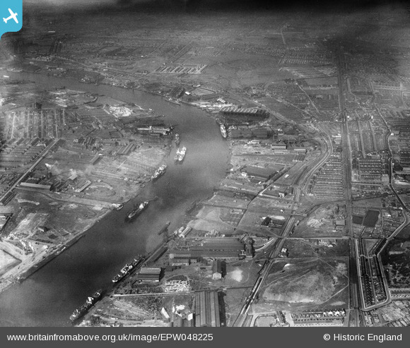
EPW048225 ENGLAND (1935). The industrial area alongside the River Tyne, Hebburn, 1935
© Copyright OpenStreetMap contributors and licensed by the OpenStreetMap Foundation. 2026. Cartography is licensed as CC BY-SA.
Nearby Images (19)
EPW048225

EPW048788

EPW050750

EAW002155

EPW048226

EPW048785

EAW007914

EAW007920

EPW054564

EAW007915

EAW007918

EAW007913

EAW007912

EPW050751

EAW007921

EAW007917

EPW051076

EPW050753

EAW002157

Details
| Title | [EPW048225] The industrial area alongside the River Tyne, Hebburn, 1935 |
| Reference | EPW048225 |
| Date | July-1935 |
| Link | |
| Place name | HEBBURN |
| Parish | |
| District | |
| Country | ENGLAND |
| Easting / Northing | 430792, 565860 |
| Longitude / Latitude | -1.5187537086439, 54.98630771288 |
| National Grid Reference | NZ308659 |
Pins

N Dunn |
Monday 9th of September 2013 07:47:51 PM | |
|
N Dunn |
Thursday 4th of July 2013 03:26:51 PM | |
|
N Dunn |
Thursday 4th of July 2013 03:25:56 PM | |
|
N Dunn |
Thursday 4th of July 2013 03:24:52 PM | |
|
N Dunn |
Thursday 4th of July 2013 03:24:20 PM | |
|
N Dunn |
Thursday 4th of July 2013 03:23:40 PM |