
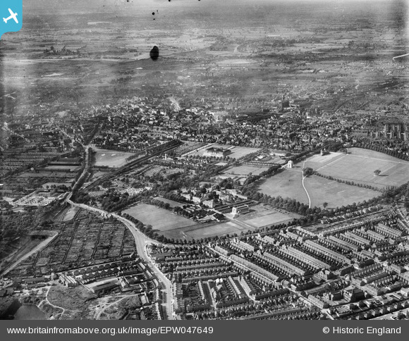
EPW047649 ENGLAND (1935). Victoria Park, University College Leicester, Welford Road Cemetery and environs, Leicester, from the south-west, 1935
© Copyright OpenStreetMap contributors and licensed by the OpenStreetMap Foundation. 2026. Cartography is licensed as CC BY-SA.
Nearby Images (6)
EPW047649

EPW047648

EPW047647

EPW055017

EPW014911

EPW047646

Details
| Title | [EPW047649] Victoria Park, University College Leicester, Welford Road Cemetery and environs, Leicester, from the south-west, 1935 |
| Reference | EPW047649 |
| Date | June-1935 |
| Link | |
| Place name | LEICESTER |
| Parish | |
| District | |
| Country | ENGLAND |
| Easting / Northing | 459266, 302712 |
| Longitude / Latitude | -1.1244894608671, 52.618585306969 |
| National Grid Reference | SK593027 |
Pins

gerry-r |
Saturday 28th of June 2014 11:58:52 PM |