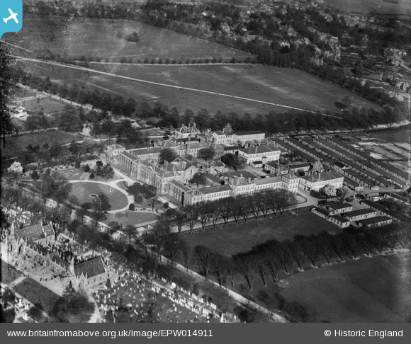
EPW014911 ENGLAND (1926). University College and Victoria Park, Leicester, 1926
© Copyright OpenStreetMap contributors and licensed by the OpenStreetMap Foundation. 2026. Cartography is licensed as CC BY-SA.
Nearby Images (6)
Details
| Title | [EPW014911] University College and Victoria Park, Leicester, 1926 |
| Reference | EPW014911 |
| Date | 11-April-1926 |
| Link | |
| Place name | LEICESTER |
| Parish | |
| District | |
| Country | ENGLAND |
| Easting / Northing | 459331, 302869 |
| Longitude / Latitude | -1.1235011749331, 52.619989597093 |
| National Grid Reference | SK593029 |
Pins

LumiX48 |
Tuesday 25th of June 2013 11:36:29 PM | |

Rebecca |
Thursday 10th of January 2013 04:15:20 PM | |

Rebecca |
Thursday 10th of January 2013 04:14:13 PM | |

Rebecca |
Thursday 10th of January 2013 04:12:43 PM | |

Underwood55 |
Tuesday 11th of December 2012 09:08:26 PM |


![[EPW014911] University College and Victoria Park, Leicester, 1926](http://britainfromabove.org.uk/sites/all/libraries/aerofilms-images/public/100x100/EPW/014/EPW014911.jpg)
![[EPW055017] The Wyggeston Grammar School for Boys and University College Leicester, Leicester, 1937](http://britainfromabove.org.uk/sites/all/libraries/aerofilms-images/public/100x100/EPW/055/EPW055017.jpg)
![[EPW047649] Victoria Park, University College Leicester, Welford Road Cemetery and environs, Leicester, from the south-west, 1935](http://britainfromabove.org.uk/sites/all/libraries/aerofilms-images/public/100x100/EPW/047/EPW047649.jpg)
![[EPW047647] Victoria Park, University College Leicester and Welford Road Cemetery, Leicester, from the south-east, 1935](http://britainfromabove.org.uk/sites/all/libraries/aerofilms-images/public/100x100/EPW/047/EPW047647.jpg)
![[EPW047648] Victoria Park, University College Leicester, Welford Road Cemetery and environs, Leicester, from the south-west, 1935](http://britainfromabove.org.uk/sites/all/libraries/aerofilms-images/public/100x100/EPW/047/EPW047648.jpg)
![[EPW047646] Victoria Park, University College Leicester and Welford Road Cemetery, Leicester, from the south-east, 1935](http://britainfromabove.org.uk/sites/all/libraries/aerofilms-images/public/100x100/EPW/047/EPW047646.jpg)