
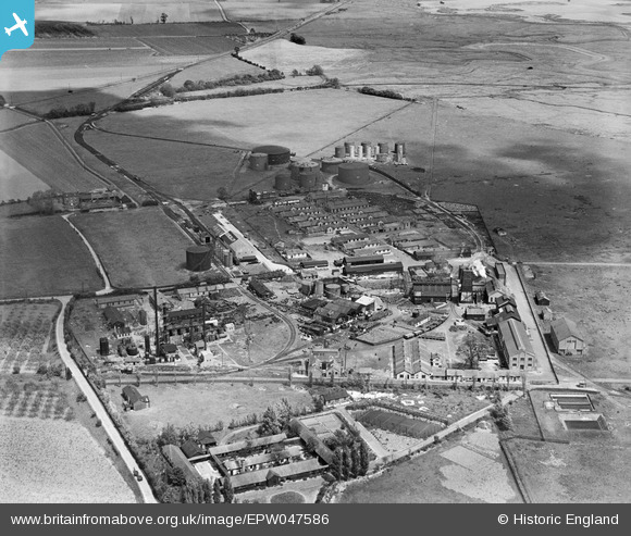
EPW047586 ENGLAND (1935). The Berry Wiggins Oil Refinery, Kingsnorth, 1935
© Copyright OpenStreetMap contributors and licensed by the OpenStreetMap Foundation. 2026. Cartography is licensed as CC BY-SA.
Nearby Images (22)
EPW047586

EPW047584

EPW047579

EPW047578

EAW032068

EPW047583

EAW000061

EAW000059

EAW000063

EPW047585

EAW032064

EAW000060

EAW032067

EPW047580

EPW000062

EAW032070

EAW000062

EPW000060A

EAW032069

EPW047582

EPW047581

EAW032071

Details
| Title | [EPW047586] The Berry Wiggins Oil Refinery, Kingsnorth, 1935 |
| Reference | EPW047586 |
| Date | June-1935 |
| Link | |
| Place name | KINGSNORTH |
| Parish | HOO ST. WERBURGH |
| District | |
| Country | ENGLAND |
| Easting / Northing | 580736, 173138 |
| Longitude / Latitude | 0.6001341818247, 51.427890971002 |
| National Grid Reference | TQ807731 |
Pins
Be the first to add a comment to this image!