
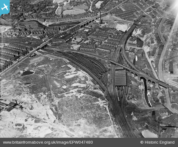
EPW047480 ENGLAND (1935). Cheetham Hill Junction and environs, Manchester, 1935
© Copyright OpenStreetMap contributors and licensed by the OpenStreetMap Foundation. 2026. Cartography is licensed as CC BY-SA.
Nearby Images (11)
EPW047480

EPW048637

EPW047479

EPW047478

EPW048663

EPW048636

EPW047481

EPW046178

EPW048631

EPW048634

EPW046176

Details
| Title | [EPW047480] Cheetham Hill Junction and environs, Manchester, 1935 |
| Reference | EPW047480 |
| Date | May-1935 |
| Link | |
| Place name | MANCHESTER |
| Parish | |
| District | |
| Country | ENGLAND |
| Easting / Northing | 385039, 400398 |
| Longitude / Latitude | -2.2255664548021, 53.499816969037 |
| National Grid Reference | SD850004 |
Pins

John Wass |
Saturday 14th of January 2017 08:41:57 PM | |
|
edqdpmad |
Wednesday 29th of May 2013 04:49:43 PM | |
It appears on a "bombing" map as St Lukes Mission Church. The base map dates from the early 1930s. I can recall no evidence of its remains in the 1950s. |
Bob |
Monday 30th of December 2013 08:00:06 PM |
|
edqdpmad |
Wednesday 29th of May 2013 04:42:24 PM | |
|
edqdpmad |
Wednesday 29th of May 2013 04:34:53 PM | |
 |
edqdpmad |
Wednesday 29th of May 2013 04:32:36 PM |