
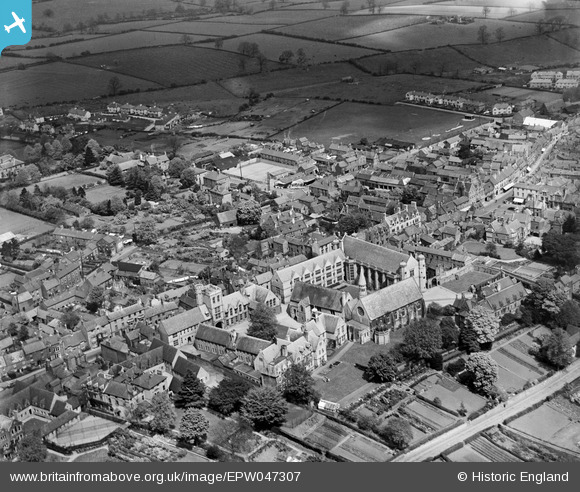
EPW047307 ENGLAND (1935). Uppingham School and the High Street, Uppingham, 1935
© Copyright OpenStreetMap contributors and licensed by the OpenStreetMap Foundation. 2026. Cartography is licensed as CC BY-SA.
Nearby Images (15)
EPW047307

EPW058208

EPW047304

EPW031884

EPW047305

EPW031887

EPW047303

EPW047306

EPW047308

EPW031888

EPW031883

EPW031886

EPW031885

EPW031857

EPW031861

Details
| Title | [EPW047307] Uppingham School and the High Street, Uppingham, 1935 |
| Reference | EPW047307 |
| Date | May-1935 |
| Link | |
| Place name | UPPINGHAM |
| Parish | UPPINGHAM |
| District | |
| Country | ENGLAND |
| Easting / Northing | 486554, 299729 |
| Longitude / Latitude | -0.72224841471703, 52.588108049527 |
| National Grid Reference | SP866997 |
Pins
Be the first to add a comment to this image!