
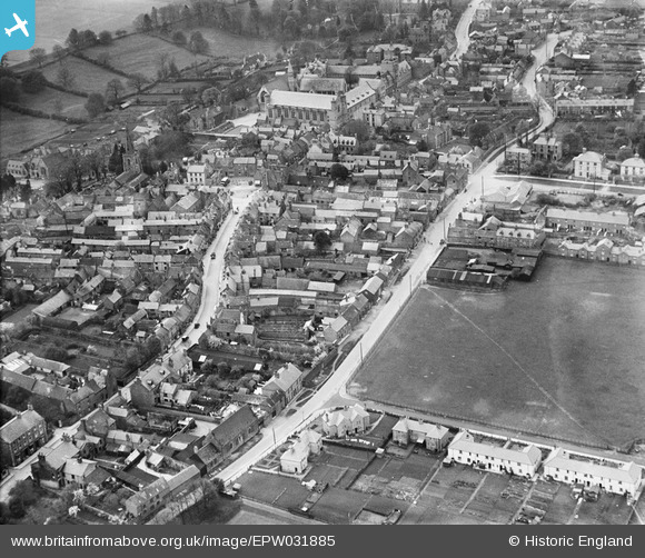
EPW031885 ENGLAND (1930). North Street, the High Street and the town centre, Uppingham, 1930
© Copyright OpenStreetMap contributors and licensed by the OpenStreetMap Foundation. 2026. Cartography is licensed as CC BY-SA.
Nearby Images (7)
EPW031885

EPW031888

EPW031857

EPW058208

EPW047307

EPW047304

EPW047303

Details
| Title | [EPW031885] North Street, the High Street and the town centre, Uppingham, 1930 |
| Reference | EPW031885 |
| Date | May-1930 |
| Link | |
| Place name | UPPINGHAM |
| Parish | UPPINGHAM |
| District | |
| Country | ENGLAND |
| Easting / Northing | 486735, 299737 |
| Longitude / Latitude | -0.71957503502665, 52.588151104778 |
| National Grid Reference | SP867997 |
Pins
Be the first to add a comment to this image!