
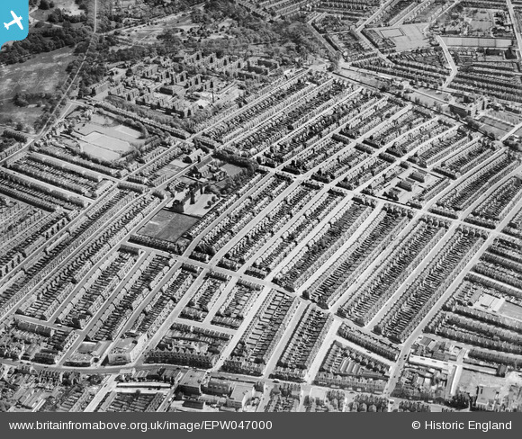
EPW047000 ENGLAND (1935). The Totterdown Fields Estate, Upper Tooting, 1935
© Copyright OpenStreetMap contributors and licensed by the OpenStreetMap Foundation. 2026. Cartography is licensed as CC BY-SA.
Nearby Images (9)
EPW047000

EPW046998

EPW047003

EPW047005

EPW047006

EPW047001

EPW046999

EPW046997

EPW047007

Details
| Title | [EPW047000] The Totterdown Fields Estate, Upper Tooting, 1935 |
| Reference | EPW047000 |
| Date | May-1935 |
| Link | |
| Place name | UPPER TOOTING |
| Parish | |
| District | |
| Country | ENGLAND |
| Easting / Northing | 528035, 171717 |
| Longitude / Latitude | -0.15804760312831, 51.429481923086 |
| National Grid Reference | TQ280717 |
Pins
Be the first to add a comment to this image!