
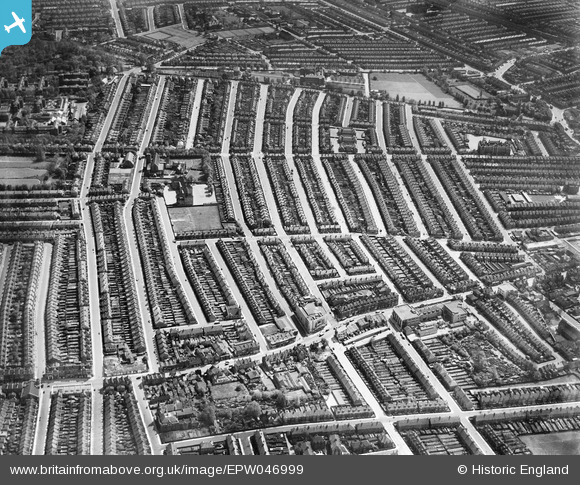
EPW046999 ENGLAND (1935). The Totterdown Fields Estate, Upper Tooting, 1935
© Copyright OpenStreetMap contributors and licensed by the OpenStreetMap Foundation. 2026. Cartography is licensed as CC BY-SA.
Nearby Images (7)
EPW046999

EPW046998

EPW047000

EPW047003

EPW047006

EPW047005

EPW047001

Details
| Title | [EPW046999] The Totterdown Fields Estate, Upper Tooting, 1935 |
| Reference | EPW046999 |
| Date | May-1935 |
| Link | |
| Place name | UPPER TOOTING |
| Parish | |
| District | |
| Country | ENGLAND |
| Easting / Northing | 527918, 171806 |
| Longitude / Latitude | -0.15969772220175, 51.430308281149 |
| National Grid Reference | TQ279718 |
