
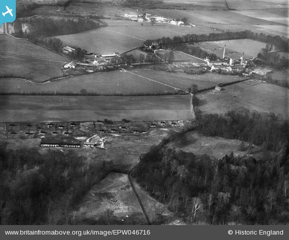
EPW046716 ENGLAND (1935). Sawston Paper Mill and livestock farming between Rayner's Grove and Park Wood, Whittlesford, 1935
© Copyright OpenStreetMap contributors and licensed by the OpenStreetMap Foundation. 2026. Cartography is licensed as CC BY-SA.
Nearby Images (6)
EPW046716

EPW046713

EPW046715

EPW046709

EPW046708

EPW046701

Details
| Title | [EPW046716] Sawston Paper Mill and livestock farming between Rayner's Grove and Park Wood, Whittlesford, 1935 |
| Reference | EPW046716 |
| Date | March-1935 |
| Link | |
| Place name | WHITTLESFORD |
| Parish | WHITTLESFORD |
| District | |
| Country | ENGLAND |
| Easting / Northing | 546950, 249073 |
| Longitude / Latitude | 0.14662440143734, 52.120002978271 |
| National Grid Reference | TL470491 |
Pins
Be the first to add a comment to this image!