
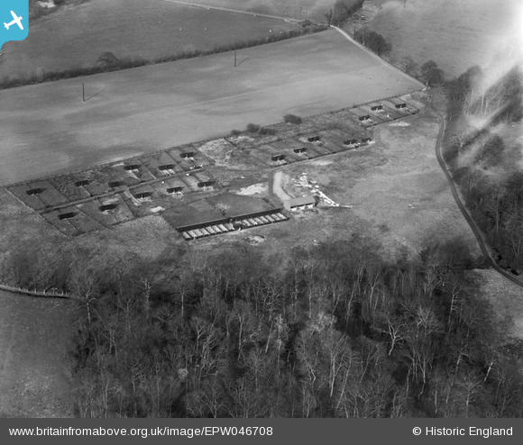
EPW046708 ENGLAND (1935). Livestock Farming between Park Wood and Rayner's Grove, Whittlesford, 1935
© Copyright OpenStreetMap contributors and licensed by the OpenStreetMap Foundation. 2026. Cartography is licensed as CC BY-SA.
Nearby Images (5)
EPW046708

EPW046709

EPW046715

EPW046716

EPW046713

Details
| Title | [EPW046708] Livestock Farming between Park Wood and Rayner's Grove, Whittlesford, 1935 |
| Reference | EPW046708 |
| Date | March-1935 |
| Link | |
| Place name | WHITTLESFORD |
| Parish | WHITTLESFORD |
| District | |
| Country | ENGLAND |
| Easting / Northing | 546854, 248913 |
| Longitude / Latitude | 0.1451540632924, 52.118590849795 |
| National Grid Reference | TL469489 |
Pins
Be the first to add a comment to this image!