
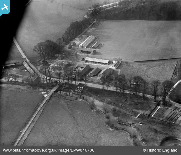
EPW046706 ENGLAND (1935). Mill Farm, Sawston, 1935
© Copyright OpenStreetMap contributors and licensed by the OpenStreetMap Foundation. 2026. Cartography is licensed as CC BY-SA.
Nearby Images (19)
EPW046706

EPW046707

EPW046704

EPW046712

EPW046703

EAW042640

EPW046701

EAW042641

EPW046699

EPW046702

EAW042646

EPW046710

EAW042643

EAW042645

EAW042642

EPW046713

EAW042644

EAW042648

EAW042647

Details
| Title | [EPW046706] Mill Farm, Sawston, 1935 |
| Reference | EPW046706 |
| Date | March-1935 |
| Link | |
| Place name | SAWSTON |
| Parish | SAWSTON |
| District | |
| Country | ENGLAND |
| Easting / Northing | 546985, 249347 |
| Longitude / Latitude | 0.14725365186112, 52.12245562764 |
| National Grid Reference | TL470493 |
Pins
Be the first to add a comment to this image!