
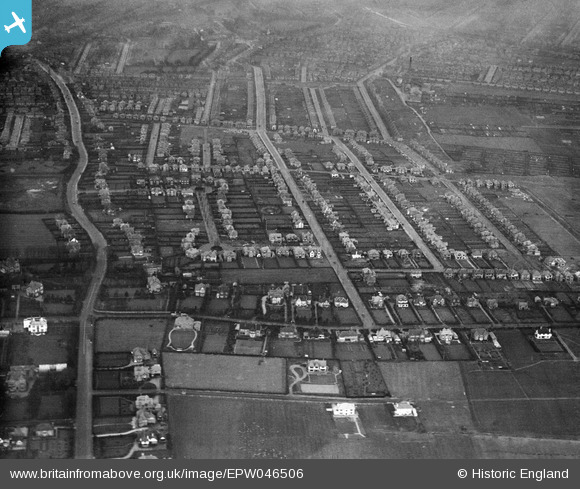
EPW046506 ENGLAND (1935). Residential area surrounding Trevor Road and Dovedale Road, West Bridgford, 1935
© Copyright OpenStreetMap contributors and licensed by the OpenStreetMap Foundation. 2025. Cartography is licensed as CC BY-SA.
Nearby Images (4)
EPW046506

EPW046505

EPW046507

EPW046509

Details
| Title | [EPW046506] Residential area surrounding Trevor Road and Dovedale Road, West Bridgford, 1935 |
| Reference | EPW046506 |
| Date | March-1935 |
| Link | |
| Place name | WEST BRIDGFORD |
| Parish | |
| District | |
| Country | ENGLAND |
| Easting / Northing | 459276, 336291 |
| Longitude / Latitude | -1.1182639872344, 52.920442941042 |
| National Grid Reference | SK593363 |
