
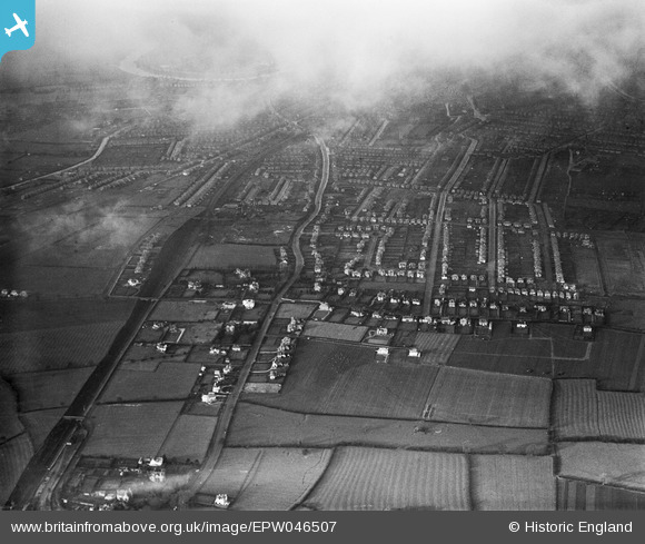
EPW046507 ENGLAND (1935). Residential area surrounding Trevor Road and Melton Road, West Bridgford, 1935
© Copyright OpenStreetMap contributors and licensed by the OpenStreetMap Foundation. 2025. Cartography is licensed as CC BY-SA.
Nearby Images (3)
EPW046507

EPW046506

EPW046505

Details
| Title | [EPW046507] Residential area surrounding Trevor Road and Melton Road, West Bridgford, 1935 |
| Reference | EPW046507 |
| Date | March-1935 |
| Link | |
| Place name | WEST BRIDGFORD |
| Parish | |
| District | |
| Country | ENGLAND |
| Easting / Northing | 459118, 336210 |
| Longitude / Latitude | -1.1206287018156, 52.919732225379 |
| National Grid Reference | SK591362 |
