
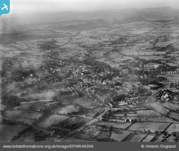
EPW046306 ENGLAND (1934). Ashbourne Road and the town, Leek, from the south-east, 1934
© Copyright OpenStreetMap contributors and licensed by the OpenStreetMap Foundation. 2026. Cartography is licensed as CC BY-SA.
Nearby Images (3)
EPW046306

EPW046310

EPW046307

Details
| Title | [EPW046306] Ashbourne Road and the town, Leek, from the south-east, 1934 |
| Reference | EPW046306 |
| Date | October-1934 |
| Link | |
| Place name | LEEK |
| Parish | LEEK |
| District | |
| Country | ENGLAND |
| Easting / Northing | 399280, 356254 |
| Longitude / Latitude | -2.0107552876271, 53.103185277287 |
| National Grid Reference | SJ993563 |
Pins

bescotbeast |
Tuesday 18th of March 2014 07:23:44 PM |