
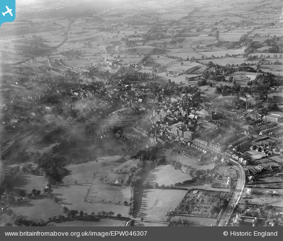
EPW046307 ENGLAND (1934). Ashbourne Road and the town, Leek, from the south-east, 1934
© Copyright OpenStreetMap contributors and licensed by the OpenStreetMap Foundation. 2026. Cartography is licensed as CC BY-SA.
Nearby Images (3)
EPW046307

EPW046306

EPW046308

Details
| Title | [EPW046307] Ashbourne Road and the town, Leek, from the south-east, 1934 |
| Reference | EPW046307 |
| Date | October-1934 |
| Link | |
| Place name | LEEK |
| Parish | LEEK |
| District | |
| Country | ENGLAND |
| Easting / Northing | 399134, 356136 |
| Longitude / Latitude | -2.0129359026377, 53.102124232983 |
| National Grid Reference | SJ991561 |
Pins

Rovaly |
Saturday 2nd of July 2016 03:01:36 PM |