
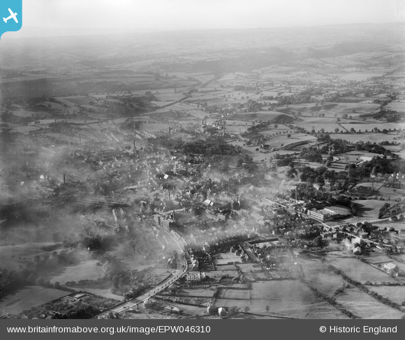
EPW046310 ENGLAND (1934). Ashbourne Road and the town, Leek, from the east, 1934
© Copyright OpenStreetMap contributors and licensed by the OpenStreetMap Foundation. 2026. Cartography is licensed as CC BY-SA.
Nearby Images (2)
EPW046310

EPW046306

Details
| Title | [EPW046310] Ashbourne Road and the town, Leek, from the east, 1934 |
| Reference | EPW046310 |
| Date | October-1934 |
| Link | |
| Place name | LEEK |
| Parish | LEEK |
| District | |
| Country | ENGLAND |
| Easting / Northing | 399258, 356402 |
| Longitude / Latitude | -2.0110842634485, 53.104515776025 |
| National Grid Reference | SJ993564 |
Pins
Be the first to add a comment to this image!