
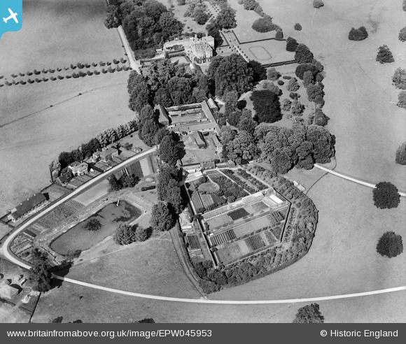
EPW045953 ENGLAND (1934). Albury Hall with the outbuildings, conduit pond and kitchen garden, Albury, 1934
© Copyright OpenStreetMap contributors and licensed by the OpenStreetMap Foundation. 2025. Cartography is licensed as CC BY-SA.
Nearby Images (7)
EPW045953

EPW045951

EPW045949

EPW045948

EPW045952

EPW045947

EPW045954

Details
| Title | [EPW045953] Albury Hall with the outbuildings, conduit pond and kitchen garden, Albury, 1934 |
| Reference | EPW045953 |
| Date | September-1934 |
| Link | |
| Place name | ALBURY |
| Parish | ALBURY |
| District | |
| Country | ENGLAND |
| Easting / Northing | 542674, 225359 |
| Longitude / Latitude | 0.074324389010617, 51.908034090797 |
| National Grid Reference | TL427254 |
Pins
Be the first to add a comment to this image!