
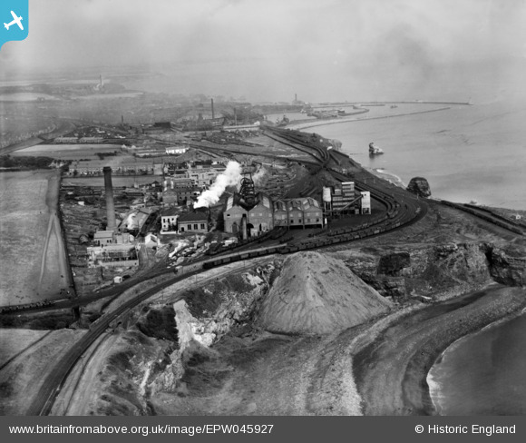
EPW045927 ENGLAND (1934). Dawdon Colliery, Seaham, from the south, 1934
© Copyright OpenStreetMap contributors and licensed by the OpenStreetMap Foundation. 2026. Cartography is licensed as CC BY-SA.
Nearby Images (7)
EPW045927

EPW045922

EPW045925

EPW045924

EPW045926

EPW045929

EPW045928

Details
| Title | [EPW045927] Dawdon Colliery, Seaham, from the south, 1934 |
| Reference | EPW045927 |
| Date | August-1934 |
| Link | |
| Place name | SEAHAM |
| Parish | SEAHAM |
| District | |
| Country | ENGLAND |
| Easting / Northing | 443619, 547678 |
| Longitude / Latitude | -1.3210497611062, 54.821952853609 |
| National Grid Reference | NZ436477 |
