
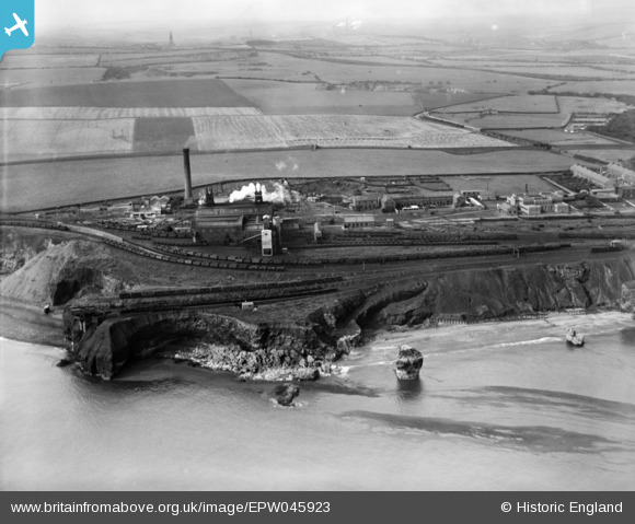
EPW045923 ENGLAND (1934). Dawdon Colliery, Seaham, from the north-east, 1934
© Copyright OpenStreetMap contributors and licensed by the OpenStreetMap Foundation. 2026. Cartography is licensed as CC BY-SA.
Nearby Images (5)
EPW045923

EPW045929

EPW045926

EPW045928

EPW045922

Details
| Title | [EPW045923] Dawdon Colliery, Seaham, from the north-east, 1934 |
| Reference | EPW045923 |
| Date | August-1934 |
| Link | |
| Place name | SEAHAM |
| Parish | SEAHAM |
| District | |
| Country | ENGLAND |
| Easting / Northing | 443785, 547955 |
| Longitude / Latitude | -1.3184241739855, 54.824427732216 |
| National Grid Reference | NZ438480 |
Pins

kevin n |
Monday 30th of May 2022 04:04:42 PM | |
|
kevin n |
Monday 30th of May 2022 04:03:22 PM | |
|
kevin n |
Monday 30th of May 2022 04:01:03 PM | |
|
kevin n |
Monday 30th of May 2022 03:59:51 PM | |
|
kevin n |
Monday 30th of May 2022 03:57:35 PM | |
|
Jack T |
Tuesday 13th of December 2016 05:43:03 PM |