
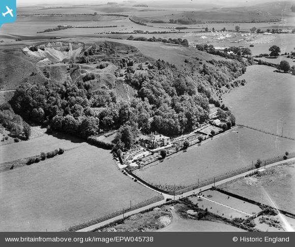
EPW045738 ENGLAND (1934). A disused quarry behind Southdown House and surrounding countryside, Warminster, 1934
© Copyright OpenStreetMap contributors and licensed by the OpenStreetMap Foundation. 2025. Cartography is licensed as CC BY-SA.
Nearby Images (12)
EPW045738

EPW045737

EPW058915

EPW058911

EPW045735

EPW045736

EPW058910

EPW058913

EPW058914

EPW058916

EPW058912

EPW045734

Details
| Title | [EPW045738] A disused quarry behind Southdown House and surrounding countryside, Warminster, 1934 |
| Reference | EPW045738 |
| Date | July-1934 |
| Link | |
| Place name | WARMINSTER |
| Parish | WARMINSTER |
| District | |
| Country | ENGLAND |
| Easting / Northing | 387515, 145985 |
| Longitude / Latitude | -2.1787606494188, 51.212415305002 |
| National Grid Reference | ST875460 |
Pins

SteveD |
Thursday 24th of July 2014 05:45:13 PM | |

Class31 |
Monday 20th of May 2013 01:57:22 PM | |
|
Class31 |
Monday 20th of May 2013 01:56:49 PM | |
|
Class31 |
Monday 20th of May 2013 01:55:48 PM | |
|
Class31 |
Monday 20th of May 2013 01:53:41 PM | |
|
Class31 |
Monday 20th of May 2013 01:53:22 PM |
User Comment Contributions
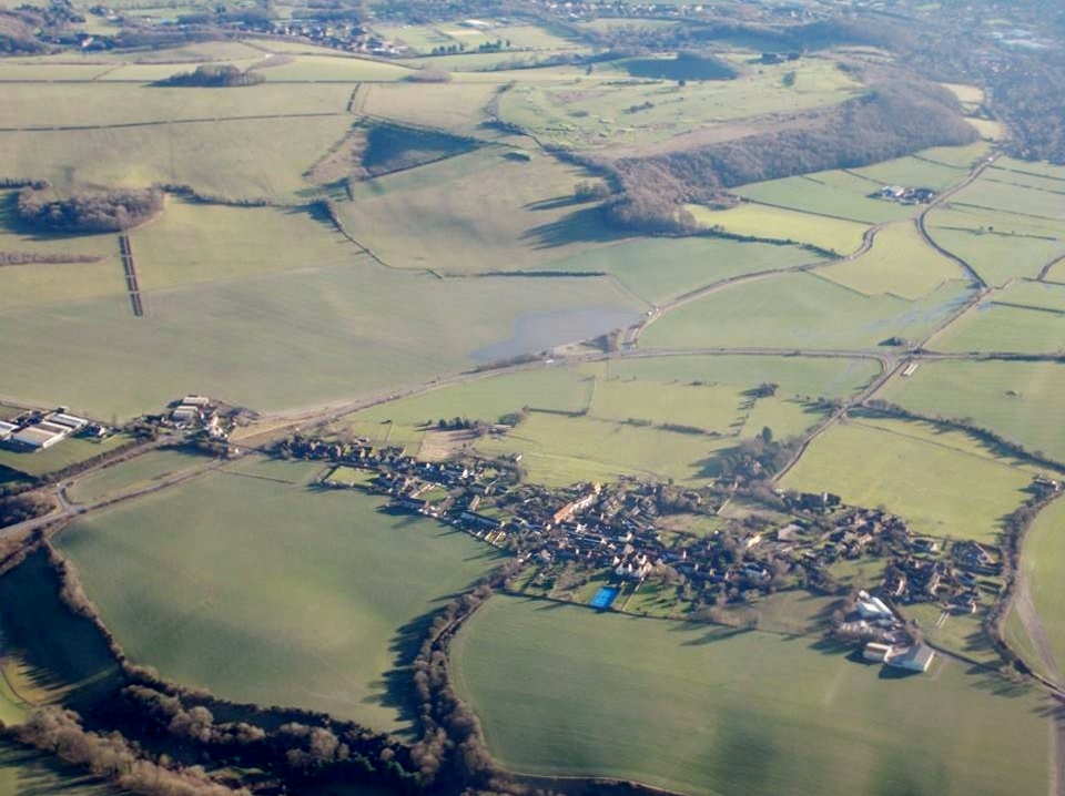
Aerial photograph taken 11 January 2014 which covers much of the same area. Photograph courtesy Con Shields. |
Class31 |
Monday 13th of January 2014 08:26:46 PM |