
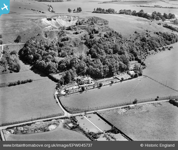
EPW045737 ENGLAND (1934). A disused quarry behind Southdown House, Warminster, 1934
© Copyright OpenStreetMap contributors and licensed by the OpenStreetMap Foundation. 2025. Cartography is licensed as CC BY-SA.
Nearby Images (12)
EPW045737

EPW045738

EPW058915

EPW058911

EPW045736

EPW058910

EPW058913

EPW045735

EPW058914

EPW058916

EPW058912

EPW045734

Details
| Title | [EPW045737] A disused quarry behind Southdown House, Warminster, 1934 |
| Reference | EPW045737 |
| Date | July-1934 |
| Link | |
| Place name | WARMINSTER |
| Parish | WARMINSTER |
| District | |
| Country | ENGLAND |
| Easting / Northing | 387512, 145976 |
| Longitude / Latitude | -2.1788032898375, 51.212334303233 |
| National Grid Reference | ST875460 |
