
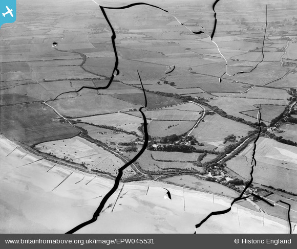
EPW045531 ENGLAND (1934). The beach, Atherington, Bailiffscourt and surrounding countryside, Atherington, from the south-east, 1934. This image has been produced from a damaged negative.
© Copyright OpenStreetMap contributors and licensed by the OpenStreetMap Foundation. 2026. Cartography is licensed as CC BY-SA.
Nearby Images (32)
EPW045531

EPW020162

EPW020161

EPW062497

EPW062504

EPW045536

EPW062495

EPW045538

EPW062494

EPW020156

EPW045537

EPW045583

EPW020152

EPW020170

EPW020153

EPW020148

EPW062496

EPW020151

EPW062498

EPW020165

EPW045533

EPW020150

EPW020160

EPW020155

EPW020157

EPW020167

EPW020172

EPW020171

EPW062492

EPW020158

EPW020169

EPW020149

Details
| Title | [EPW045531] The beach, Atherington, Bailiffscourt and surrounding countryside, Atherington, from the south-east, 1934. This image has been produced from a damaged negative. |
| Reference | EPW045531 |
| Date | July-1934 |
| Link | |
| Place name | ATHERINGTON |
| Parish | CLIMPING |
| District | |
| Country | ENGLAND |
| Easting / Northing | 500312, 100760 |
| Longitude / Latitude | -0.57646684384951, 50.797146042707 |
| National Grid Reference | TQ003008 |
Pins
Be the first to add a comment to this image!