
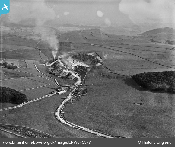
EPW045377 ENGLAND (1934). The Tar Refinery and Hillhead Limestone Quarry, Staker Hill, from the north-west, 1934. This image has been produced from a damaged negative.
© Copyright OpenStreetMap contributors and licensed by the OpenStreetMap Foundation. 2026. Cartography is licensed as CC BY-SA.
Nearby Images (4)
EPW045377

EPW051660

EPW051661

EPW051658

Details
| Title | [EPW045377] The Tar Refinery and Hillhead Limestone Quarry, Staker Hill, from the north-west, 1934. This image has been produced from a damaged negative. |
| Reference | EPW045377 |
| Date | July-1934 |
| Link | |
| Place name | STAKER HILL |
| Parish | HARTINGTON UPPER QUARTER |
| District | |
| Country | ENGLAND |
| Easting / Northing | 406998, 370018 |
| Longitude / Latitude | -1.895163573182, 53.226877573839 |
| National Grid Reference | SK070700 |
Pins
Be the first to add a comment to this image!