
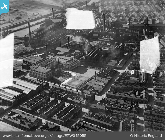
EPW045055 ENGLAND (1934). The E Griffiths Hughes Chemical Works and environs, Salford, 1934. This image was marked by Aerofilms Ltd for photo editing.
© Copyright OpenStreetMap contributors and licensed by the OpenStreetMap Foundation. 2026. Cartography is licensed as CC BY-SA.
Nearby Images (16)
EPW045055

EPW045059

EPW045056

EPW045057

EPW045058

EPW045054

EAW039820

EAW039822

EAW039821

EAW039825

EAW039819

EAW039827

EAW039818

EAW039826

EAW039824

EAW039823

Details
| Title | [EPW045055] The E Griffiths Hughes Chemical Works and environs, Salford, 1934. This image was marked by Aerofilms Ltd for photo editing. |
| Reference | EPW045055 |
| Date | June-1934 |
| Link | |
| Place name | SALFORD |
| Parish | |
| District | |
| Country | ENGLAND |
| Easting / Northing | 382589, 398922 |
| Longitude / Latitude | -2.2624226952784, 53.486473241576 |
| National Grid Reference | SJ826989 |
Pins

Bottom Yard |
Saturday 2nd of March 2019 05:24:22 PM | |
|
Bottom Yard |
Saturday 2nd of March 2019 05:23:29 PM | |
|
Bottom Yard |
Saturday 2nd of March 2019 05:22:05 PM | |
|
Bottom Yard |
Saturday 2nd of March 2019 05:20:07 PM | |
|
Bottom Yard |
Saturday 2nd of March 2019 04:09:12 PM | |
|
Bottom Yard |
Saturday 2nd of March 2019 04:03:52 PM | |
|
Bottom Yard |
Saturday 2nd of March 2019 03:45:42 PM | |
|
Bottom Yard |
Saturday 2nd of March 2019 03:42:45 PM | |
|
Bottom Yard |
Saturday 2nd of March 2019 03:38:12 PM | |
|
boltie |
Sunday 12th of January 2014 01:14:00 PM | |
|
boltie |
Sunday 12th of January 2014 01:12:40 PM | |
|
boltie |
Sunday 12th of January 2014 01:11:49 PM | |
|
boltie |
Sunday 12th of January 2014 01:10:01 PM |