
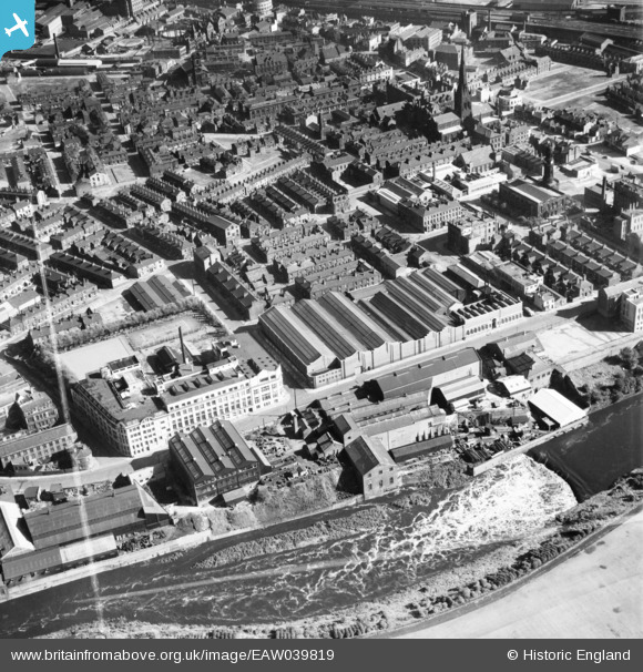
EAW039819 ENGLAND (1951). The Adelephi Iron Works, E Griffiths Hughes Chemical Factory and environs, Salford, 1951.This image was marked by Aerofilms Ltd for photo editing.
© Copyright OpenStreetMap contributors and licensed by the OpenStreetMap Foundation. 2026. Cartography is licensed as CC BY-SA.
Nearby Images (16)
EAW039819

EAW039827

EAW039826

EAW039825

EAW039822

EAW039824

EAW039818

EPW045054

EAW039820

EPW045056

EPW045057

EAW039821

EPW045059

EPW045055

EAW039823

EPW045058

Details
| Title | [EAW039819] The Adelephi Iron Works, E Griffiths Hughes Chemical Factory and environs, Salford, 1951.This image was marked by Aerofilms Ltd for photo editing. |
| Reference | EAW039819 |
| Date | 15-September-1951 |
| Link | |
| Place name | SALFORD |
| Parish | |
| District | |
| Country | ENGLAND |
| Easting / Northing | 382566, 398786 |
| Longitude / Latitude | -2.2627617973661, 53.485249923159 |
| National Grid Reference | SJ826988 |
Pins

stardelta |
Tuesday 5th of January 2021 09:13:57 PM | |
|
stardelta |
Tuesday 5th of January 2021 09:09:09 PM | |
|
stardelta |
Tuesday 5th of January 2021 09:03:45 PM | |
|
boltie |
Sunday 30th of October 2016 02:35:02 PM |