
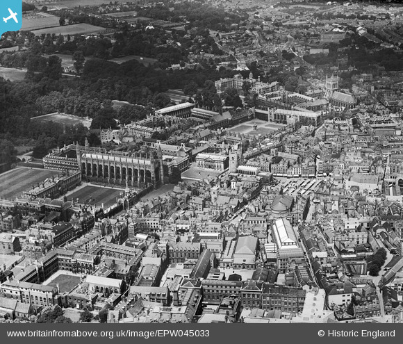
EPW045033 ENGLAND (1934). King's College Chapel, Trinity College and the town, Cambridge, 1934
© Copyright OpenStreetMap contributors and licensed by the OpenStreetMap Foundation. 2026. Cartography is licensed as CC BY-SA.
Nearby Images (40)
EPW045033

EPW059042

EPW059036

EAW002925

EAW002922

EAW002923

EPW009772

EPW059037

EPW009771

EAW002916

EAW002924

EPW000046

EAW011270

EPW025478

EPW059038

EAW002917

EPW009782

EPW059041

EPW025481

EPW025476

EPW000045

EAW004873

EAW051759

EPW009779

EPW000053

EPW000057

EPW009783

EPW045031

EPW009777

EPW045030

EAW002918

EAW003561

EPW045029

EPW009776

EAW012469

EPW009781

EAW004874

EAW012463

EAW002915

EPW045032

Details
| Title | [EPW045033] King's College Chapel, Trinity College and the town, Cambridge, 1934 |
| Reference | EPW045033 |
| Date | June-1934 |
| Link | |
| Place name | CAMBRIDGE |
| Parish | |
| District | |
| Country | ENGLAND |
| Easting / Northing | 544773, 258469 |
| Longitude / Latitude | 0.11885431668086, 52.205003762481 |
| National Grid Reference | TL448585 |
Pins
Be the first to add a comment to this image!