
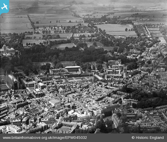
EPW045032 ENGLAND (1934). The grounds of several of the Colleges and the town, Cambridge, 1934
© Copyright OpenStreetMap contributors and licensed by the OpenStreetMap Foundation. 2026. Cartography is licensed as CC BY-SA.
Nearby Images (29)
EPW045032

EAW014115

EAW002915

EPW009776

EPW009777

EPW009783

EPW025479

EAW011269

EPW009786

EPW009787

EAW002914
, Cambridge, 1946")
EAW051758

EPW000050

EPW009789

EAW004873

EAW002916

EPW009779

EPW000045

EAW002923

EAW002922

EAW051760

EPW045029

EPW000053

EPW025467
, Cambridge, 1928. This image has been produced from a copy-negative.")
EAW051759

EPW059036

EAW002925

EPW045033

EPW059042

Details
| Title | [EPW045032] The grounds of several of the Colleges and the town, Cambridge, 1934 |
| Reference | EPW045032 |
| Date | June-1934 |
| Link | |
| Place name | CAMBRIDGE |
| Parish | |
| District | |
| Country | ENGLAND |
| Easting / Northing | 544621, 258689 |
| Longitude / Latitude | 0.11672530876431, 52.207020433676 |
| National Grid Reference | TL446587 |
Pins
Be the first to add a comment to this image!