
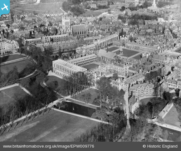
EPW009776 ENGLAND (1924). Trinity College, Cambridge, 1924
© Copyright OpenStreetMap contributors and licensed by the OpenStreetMap Foundation. 2026. Cartography is licensed as CC BY-SA.
Nearby Images (42)
EPW009776

EPW009777

EPW009783

EPW045032

EAW004873

EPW009779

EPW000045

EAW002916

EAW002915

EAW002923

EAW014115

EAW002922

EPW045029

EPW000053

EAW011269

EPW025479

EPW059036

EAW002925

EPW025476

EAW051758

EPW009786

EPW045031

EPW045033

EPW009787

EAW051759

EPW009772

EAW002914
, Cambridge, 1946")
EAW002917

EPW009782

EPW000050

EPW000046

EPW059042

EPW025481

EPW059038

EPW009771

EPW009789

EPW025478

EAW011270

EAW051760

EPW059037

EAW002924

EPW059041

Details
| Title | [EPW009776] Trinity College, Cambridge, 1924 |
| Reference | EPW009776 |
| Date | March-1924 |
| Link | |
| Place name | CAMBRIDGE |
| Parish | |
| District | |
| Country | ENGLAND |
| Easting / Northing | 544620, 258604 |
| Longitude / Latitude | 0.11667437443341, 52.206256946997 |
| National Grid Reference | TL446586 |
Pins
Be the first to add a comment to this image!