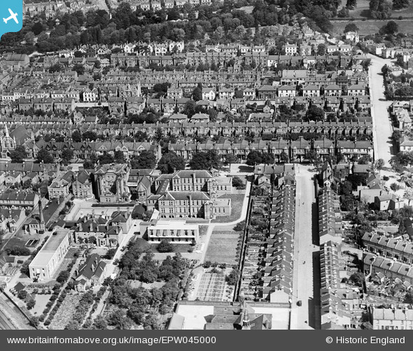
EPW045000 ENGLAND (1934). Warneford Hospital and surrounding residential area, Royal Leamington Spa, 1934
© Copyright OpenStreetMap contributors and licensed by the OpenStreetMap Foundation. 2026. Cartography is licensed as CC BY-SA.
Nearby Images (7)
Details
| Title | [EPW045000] Warneford Hospital and surrounding residential area, Royal Leamington Spa, 1934 |
| Reference | EPW045000 |
| Date | June-1934 |
| Link | |
| Place name | ROYAL LEAMINGTON SPA |
| Parish | ROYAL LEAMINGTON SPA |
| District | |
| Country | ENGLAND |
| Easting / Northing | 432436, 265224 |
| Longitude / Latitude | -1.5244602200365, 52.283806543483 |
| National Grid Reference | SP324652 |
Pins
Be the first to add a comment to this image!


![[EPW045000] Warneford Hospital and surrounding residential area, Royal Leamington Spa, 1934](http://britainfromabove.org.uk/sites/all/libraries/aerofilms-images/public/100x100/EPW/045/EPW045000.jpg)
![[EPW044999] Warneford Hospital and surrounding residential area, Royal Leamington Spa, 1934](http://britainfromabove.org.uk/sites/all/libraries/aerofilms-images/public/100x100/EPW/044/EPW044999.jpg)
![[EPW045001] Warneford Hospital and surrounding residential area, Royal Leamington Spa, 1934](http://britainfromabove.org.uk/sites/all/libraries/aerofilms-images/public/100x100/EPW/045/EPW045001.jpg)
![[EPW045002] Warneford Hospital and surrounding residential area, Royal Leamington Spa, 1934](http://britainfromabove.org.uk/sites/all/libraries/aerofilms-images/public/100x100/EPW/045/EPW045002.jpg)
![[EPW045003] Warneford Hospital, the Eagle Stove Foundry and surrounding residential area, Royal Leamington Spa, 1934](http://britainfromabove.org.uk/sites/all/libraries/aerofilms-images/public/100x100/EPW/045/EPW045003.jpg)
![[EAW024690] The town, Royal Leamington Spa, from the south-east, 1949](http://britainfromabove.org.uk/sites/all/libraries/aerofilms-images/public/100x100/EAW/024/EAW024690.jpg)
![[EAW024689] The town, Royal Leamington Spa, from the east, 1949](http://britainfromabove.org.uk/sites/all/libraries/aerofilms-images/public/100x100/EAW/024/EAW024689.jpg)