
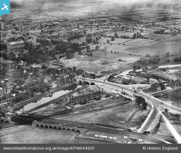
EPW044920 ENGLAND (1934). London Road Bridge, the River Nene and environs, Peterborough, 1934
© Copyright OpenStreetMap contributors and licensed by the OpenStreetMap Foundation. 2026. Cartography is licensed as CC BY-SA.
Nearby Images (28)
EPW044920

EPW044918

EPW044921

EPW044919

EPW044922

EPW036796

EPW044905

EPW044906

EPW036807

EPW036803

EPW036794

EPW039168

EPW036795

EPW036801

EPW036793

EPW036799

EPW036805

EPW036806

EPW044912

EPW036804

EPW036809

EPW036800

EPW044911

EPW044910

EAW005690

EPW044904

EPW050306

EAW009524

Details
| Title | [EPW044920] London Road Bridge, the River Nene and environs, Peterborough, 1934 |
| Reference | EPW044920 |
| Date | June-1934 |
| Link | |
| Place name | PETERBOROUGH |
| Parish | |
| District | |
| Country | ENGLAND |
| Easting / Northing | 519327, 298201 |
| Longitude / Latitude | -0.23920258072255, 52.568170365828 |
| National Grid Reference | TL193982 |


