
EPW044911 ENGLAND (1934). The Cathedral Church of St Peter, St Paul and St Andrew and the city, Peterborough, from the south, 1934

© Copyright OpenStreetMap contributors and licensed by the OpenStreetMap Foundation. 2026. Cartography is licensed as CC BY-SA.
Nearby Images (26)
EPW044911

EPW044912

EPW036796

EPW036801

EPW036793

EPW036805

EPW036804

EPW036809

EPW036794

EPW044906

EPW044904

EPW036800

EPW036803

EPW044921

EPW044918

EPW044920

EPW044919

EPW036807

EPW044905

EPW044922

EPW036795

EPW036806

EPW036799

EPW036802

EPW036797

EPW036808

Details
| Title | [EPW044911] The Cathedral Church of St Peter, St Paul and St Andrew and the city, Peterborough, from the south, 1934 |
| Reference | EPW044911 |
| Date | June-1934 |
| Link | |
| Place name | PETERBOROUGH |
| Parish | |
| District | |
| Country | ENGLAND |
| Easting / Northing | 519392, 298037 |
| Longitude / Latitude | -0.23830300309019, 52.566682296889 |
| National Grid Reference | TL194980 |
Pins

gBr |
Tuesday 1st of December 2015 08:17:06 PM | |

Class31 |
Wednesday 11th of June 2014 08:31:46 PM | |
|
Class31 |
Wednesday 11th of June 2014 08:13:31 AM |


User Comment Contributions
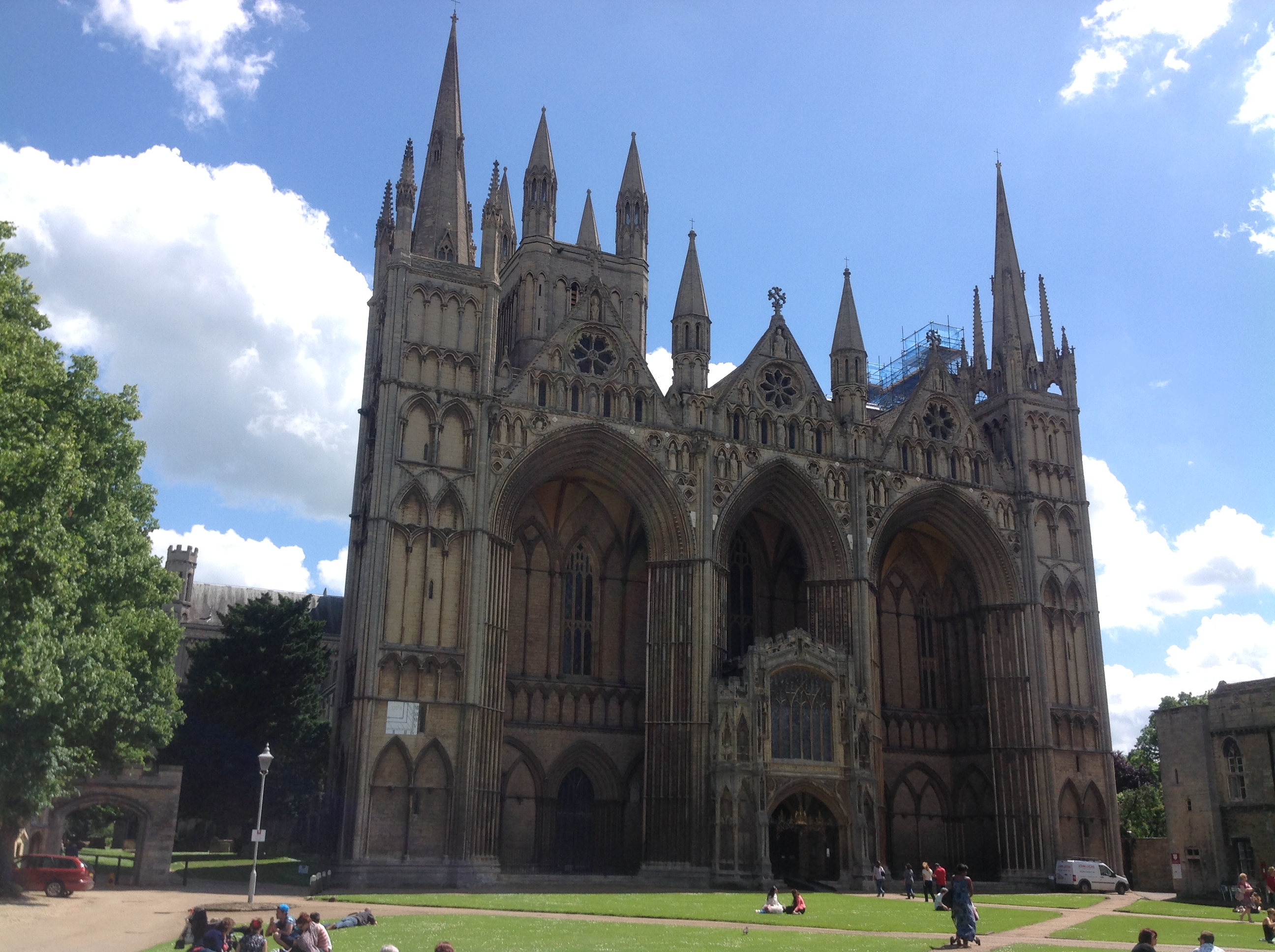
Peterborough Cathedral, properly the Cathedral Church of St Peter, St Paul and St Andrew – also known as Saint Peter's Cathedral, Peterborough , 10/06/2014 |
Class31 |
Wednesday 11th of June 2014 08:31:38 AM |