
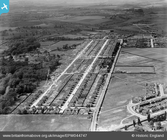
EPW044747 ENGLAND (1934). Powder Mill Lane and housing under construction along Waverley Avenue and Lyndhurst Avenue, Twickenham, 1934
© Copyright OpenStreetMap contributors and licensed by the OpenStreetMap Foundation. 2026. Cartography is licensed as CC BY-SA.
Nearby Images (6)
EPW044747

EPW044333

EPW044336

EPW044743

EPW044748

EPW044745

Details
| Title | [EPW044747] Powder Mill Lane and housing under construction along Waverley Avenue and Lyndhurst Avenue, Twickenham, 1934 |
| Reference | EPW044747 |
| Date | June-1934 |
| Link | |
| Place name | TWICKENHAM |
| Parish | |
| District | |
| Country | ENGLAND |
| Easting / Northing | 513166, 173139 |
| Longitude / Latitude | -0.3714042190085, 51.445429560923 |
| National Grid Reference | TQ132731 |
Pins

Inga |
Tuesday 9th of February 2021 10:35:37 PM |