
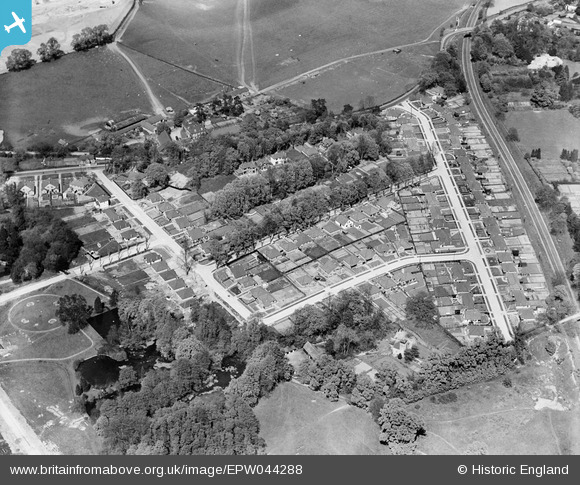
EPW044288 ENGLAND (1934). Housing development at Lambarde Road and environs, Sevenoaks, 1934
© Copyright OpenStreetMap contributors and licensed by the OpenStreetMap Foundation. 2026. Cartography is licensed as CC BY-SA.
Nearby Images (9)
EPW044288

EPW044290

EPW044289

EPW044291

EPW044286

EPW044287

EPW038238

EPW038241

EPW038243

Details
| Title | [EPW044288] Housing development at Lambarde Road and environs, Sevenoaks, 1934 |
| Reference | EPW044288 |
| Date | May-1934 |
| Link | |
| Place name | SEVENOAKS |
| Parish | SEVENOAKS |
| District | |
| Country | ENGLAND |
| Easting / Northing | 552226, 156203 |
| Longitude / Latitude | 0.18308137492732, 51.284087812618 |
| National Grid Reference | TQ522562 |
Pins
Be the first to add a comment to this image!