
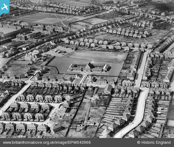
EPW043966 ENGLAND (1934). Hounslow Heath Junior School and the surrounding residential area, Hounslow West, 1934
© Copyright OpenStreetMap contributors and licensed by the OpenStreetMap Foundation. 2026. Cartography is licensed as CC BY-SA.
Nearby Images (6)
EPW043966

EPW043965

EPW043969

EPW043967

EPW043964

EPW043968

Details
| Title | [EPW043966] Hounslow Heath Junior School and the surrounding residential area, Hounslow West, 1934 |
| Reference | EPW043966 |
| Date | April-1934 |
| Link | |
| Place name | HOUNSLOW WEST |
| Parish | |
| District | |
| Country | ENGLAND |
| Easting / Northing | 512376, 175489 |
| Longitude / Latitude | -0.38202155271585, 51.466711021944 |
| National Grid Reference | TQ124755 |
Pins

Leslie B |
Monday 11th of July 2022 01:20:38 PM |