
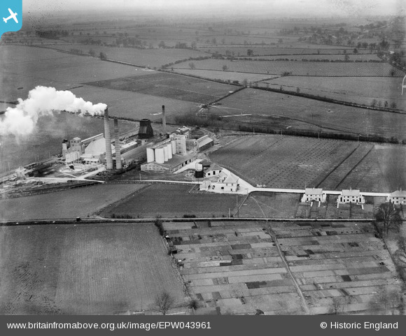
EPW043961 ENGLAND (1934). The Ketton Portland Cement Co Works and surrounding countryside, Ketton, 1934
© Copyright OpenStreetMap contributors and licensed by the OpenStreetMap Foundation. 2026. Cartography is licensed as CC BY-SA.
Nearby Images (19)
EPW043961

EPW028843

EPW028844

EPW028848

EPW043962

EPW028846

EPW028842

EAW000250

EPW043960

EPW028847

EPW043959

EPW028845

EAW000249

EAW000253

EAW000252

EAW000251

EPW043958

EPW043956

EAW000254

Details
| Title | [EPW043961] The Ketton Portland Cement Co Works and surrounding countryside, Ketton, 1934 |
| Reference | EPW043961 |
| Date | April-1934 |
| Link | |
| Place name | KETTON |
| Parish | KETTON |
| District | |
| Country | ENGLAND |
| Easting / Northing | 498562, 305425 |
| Longitude / Latitude | -0.54334070252769, 52.637258373231 |
| National Grid Reference | SK986054 |
Pins

Dylan Moore |
Tuesday 7th of May 2013 02:53:42 PM | |
|
Dylan Moore |
Tuesday 7th of May 2013 02:52:54 PM | |
|
Dylan Moore |
Tuesday 7th of May 2013 02:52:31 PM | |
|
Dylan Moore |
Tuesday 7th of May 2013 02:52:08 PM |