
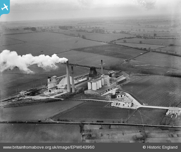
EPW043960 ENGLAND (1934). The Ketton Portland Cement Co Works and surrounding countryside, Ketton, from the south-west, 1934
© Copyright OpenStreetMap contributors and licensed by the OpenStreetMap Foundation. 2026. Cartography is licensed as CC BY-SA.
Nearby Images (18)
EPW043960

EPW043959

EPW043962

EAW000250

EPW028847

EPW028845

EPW028842

EPW043961

EPW028844

EPW028848

EPW028843

EAW000253

EPW028846

EPW043956

EAW000252

EPW043958

EAW000249

EAW000251

Details
| Title | [EPW043960] The Ketton Portland Cement Co Works and surrounding countryside, Ketton, from the south-west, 1934 |
| Reference | EPW043960 |
| Date | April-1934 |
| Link | |
| Place name | KETTON |
| Parish | KETTON |
| District | |
| Country | ENGLAND |
| Easting / Northing | 498452, 305394 |
| Longitude / Latitude | -0.54497508066255, 52.63699972032 |
| National Grid Reference | SK985054 |
Pins

Dylan Moore |
Tuesday 7th of May 2013 02:50:24 PM | |
|
Dylan Moore |
Tuesday 7th of May 2013 02:49:53 PM | |
|
Dylan Moore |
Tuesday 7th of May 2013 02:49:29 PM | |
|
Dylan Moore |
Tuesday 7th of May 2013 02:48:58 PM | |
|
Dylan Moore |
Tuesday 7th of May 2013 02:48:12 PM | |
|
Dylan Moore |
Tuesday 7th of May 2013 02:47:45 PM | |
|
Dylan Moore |
Tuesday 7th of May 2013 02:46:47 PM |
User Comment Contributions

I worked at the Ketton site 2007 - 2010 as Engineering Manager and had the opportunity to take a balloon flight directly over the site. A picture taken from a similar angle and height is attached. The difference then and know is staggering. |

Lux 208 |
Tuesday 13th of May 2014 04:52:33 PM |