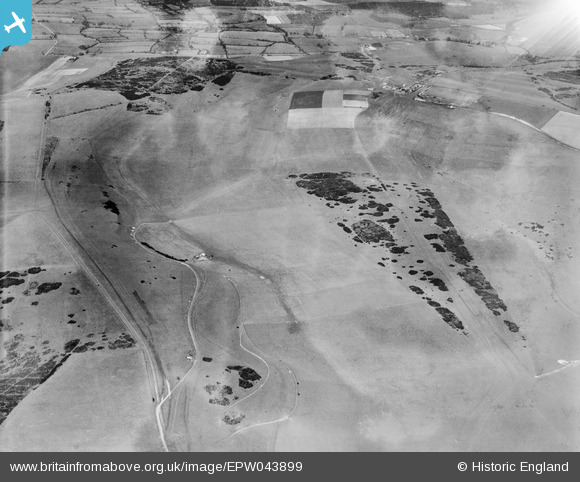
EPW043899 ENGLAND (1934). Benfield Hill, Mount Zion and environs, South Downs, 1934
© Copyright OpenStreetMap contributors and licensed by the OpenStreetMap Foundation. 2026. Cartography is licensed as CC BY-SA.
Details
| Title | [EPW043899] Benfield Hill, Mount Zion and environs, South Downs, 1934 |
| Reference | EPW043899 |
| Date | March-1934 |
| Link | |
| Place name | SOUTH DOWNS |
| Parish | |
| District | |
| Country | ENGLAND |
| Easting / Northing | 525468, 109208 |
| Longitude / Latitude | -0.21675026143868, 50.868185703908 |
| National Grid Reference | TQ255092 |
Pins
Be the first to add a comment to this image!


![[EPW043899] Benfield Hill, Mount Zion and environs, South Downs, 1934](http://britainfromabove.org.uk/sites/all/libraries/aerofilms-images/public/100x100/EPW/043/EPW043899.jpg)
![[EPW043897] Benfield Hill, Mount Zion and environs, South Downs, 1934. This image has been produced from a damaged negative.](http://britainfromabove.org.uk/sites/all/libraries/aerofilms-images/public/100x100/EPW/043/EPW043897.jpg)
![[EPW043898] Benfield Hill, Mount Zion and environs, South Downs, 1934](http://britainfromabove.org.uk/sites/all/libraries/aerofilms-images/public/100x100/EPW/043/EPW043898.jpg)
![[EPW043891] Benfield Hill and environs, South Downs, 1934](http://britainfromabove.org.uk/sites/all/libraries/aerofilms-images/public/100x100/EPW/043/EPW043891.jpg)