
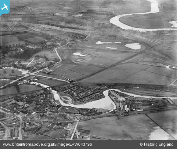
EPW043796 ENGLAND (1934). The Hurrocks Allotment Gardens, the River Derwent and environs, Blaydon, from the east, 1934
© Copyright OpenStreetMap contributors and licensed by the OpenStreetMap Foundation. 2026. Cartography is licensed as CC BY-SA.
Nearby Images (7)
EPW043796

EAW033908

EAW016736
 Works at Derwent Haugh, Swalwell, from the south, 1948. This image was marked by Aerofilms Ltd for photo editing.")
EAW016737
 Works at Derwent Haugh, Swalwell, from the south-east, 1948. This image was marked by Aerofilms Ltd for photo editing.")
EAW016732
 Works at Derwent Haugh, Swalwell, 1948. This image was marked by Aerofilms Ltd for photo editing.")
EAW016734
 Works at Derwent Haugh, Swalwell, 1948. This image was marked by Aerofilms Ltd for photo editing.")
EAW016738
 Works at Derwent Haugh, Swalwell, from the south-east, 1948. This image was marked by Aerofilms Ltd for photo editing.")
Details
| Title | [EPW043796] The Hurrocks Allotment Gardens, the River Derwent and environs, Blaydon, from the east, 1934 |
| Reference | EPW043796 |
| Date | February-1934 |
| Link | |
| Place name | BLAYDON |
| Parish | |
| District | |
| Country | ENGLAND |
| Easting / Northing | 420241, 562611 |
| Longitude / Latitude | -1.6838805313772, 54.957649104242 |
| National Grid Reference | NZ202626 |
Pins

Tired Hiker |
Sunday 2nd of February 2025 02:10:32 PM |