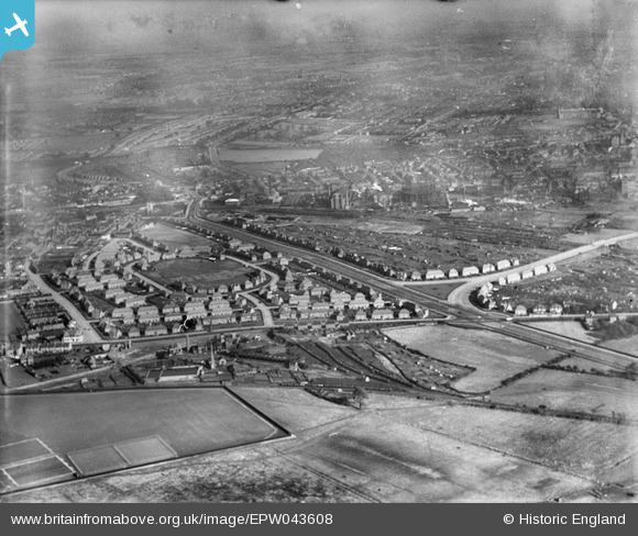
EPW043608 ENGLAND (1933). The Newcastle Colliery and housing at Bracknell Crescent and the Western Boulevard, Whitemoor, 1933
    © Copyright OpenStreetMap contributors and licensed by the OpenStreetMap Foundation. 2025. Cartography is licensed as CC BY-SA.
  
Details
| Title | [EPW043608] The Newcastle Colliery and housing at Bracknell Crescent and the Western Boulevard, Whitemoor, 1933 | 
| Reference | EPW043608 | 
| Date | October-1933 | 
| Link | |
| Place name | WHITEMOOR | 
| Parish | |
| District | |
| Country | ENGLAND | 
| Easting / Northing | 454620, 342115 | 
| Longitude / Latitude | -1.1865329046166, 52.973290885095 | 
| National Grid Reference | SK546421 | 
Pins
Be the first to add a comment to this image!
 
             
  ![[EPW043608] The Newcastle Colliery and housing at Bracknell Crescent and the Western Boulevard, Whitemoor, 1933](http://britainfromabove.org.uk/sites/all/libraries/aerofilms-images/public/100x100/EPW/043/EPW043608.jpg) 
  
                                          ![[EPW038037] The new housing estate, Aspley, from the south-east, 1932](http://britainfromabove.org.uk/sites/all/libraries/aerofilms-images/public/100x100/EPW/038/EPW038037.jpg) 
 ![[EPW043938] The Newcastle Colliery and housing at Bracknell Crescent and the Western Boulevard, Whitemoor, from the south-west, 1934](http://britainfromabove.org.uk/sites/all/libraries/aerofilms-images/public/100x100/EPW/043/EPW043938.jpg) 
 ![[EPW038029] The new housing estate, Aspley, from the south-east, 1932](http://britainfromabove.org.uk/sites/all/libraries/aerofilms-images/public/100x100/EPW/038/EPW038029.jpg)