
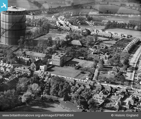
EPW043584 ENGLAND (1933). The Grange and the Telephone Exchange alongside the Gas Works, Roxeth, 1933
© Copyright OpenStreetMap contributors and licensed by the OpenStreetMap Foundation. 2026. Cartography is licensed as CC BY-SA.
Nearby Images (7)
EPW043584

EPW043582

EPW043580

EPW043585

EPW043581

EPW043583

EPW009579

Details
| Title | [EPW043584] The Grange and the Telephone Exchange alongside the Gas Works, Roxeth, 1933 |
| Reference | EPW043584 |
| Date | October-1933 |
| Link | |
| Place name | ROXETH |
| Parish | |
| District | |
| Country | ENGLAND |
| Easting / Northing | 514480, 186836 |
| Longitude / Latitude | -0.34805513492919, 51.568284541422 |
| National Grid Reference | TQ145868 |
Pins

The Laird |
Wednesday 6th of January 2016 02:59:47 PM | |
|
The Laird |
Wednesday 16th of September 2015 12:24:04 PM | |
|
The Laird |
Tuesday 15th of September 2015 09:54:44 PM | |
|
The Laird |
Saturday 21st of March 2015 11:01:03 PM | |
|
The Laird |
Saturday 21st of March 2015 09:29:29 PM | |
|
The Laird |
Saturday 21st of March 2015 09:16:18 PM | |
|
Caretaker |
Saturday 6th of December 2014 06:19:24 PM |