
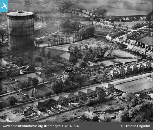
EPW043582 ENGLAND (1933). The Grange alongside the Gas Works, Roxeth, 1933
© Copyright OpenStreetMap contributors and licensed by the OpenStreetMap Foundation. 2026. Cartography is licensed as CC BY-SA.
Nearby Images (7)
EPW043582

EPW043580

EPW043585

EPW043581

EPW043584

EPW043583

EPW009579

Details
| Title | [EPW043582] The Grange alongside the Gas Works, Roxeth, 1933 |
| Reference | EPW043582 |
| Date | October-1933 |
| Link | |
| Place name | ROXETH |
| Parish | |
| District | |
| Country | ENGLAND |
| Easting / Northing | 514413, 186878 |
| Longitude / Latitude | -0.34900783392979, 51.568675667022 |
| National Grid Reference | TQ144869 |
Pins

The Laird |
Tuesday 15th of September 2015 08:59:45 PM | |
|
The Laird |
Wednesday 25th of June 2014 07:12:49 PM | |
|
JamesMac |
Tuesday 22nd of October 2013 06:28:39 PM | |
|
JamesMac |
Tuesday 22nd of October 2013 06:27:00 PM | |
|
JamesMac |
Tuesday 22nd of October 2013 06:25:06 PM | |
|
JamesMac |
Tuesday 22nd of October 2013 06:23:43 PM | |
|
JamesMac |
Tuesday 22nd of October 2013 06:21:32 PM | |
|
JamesMac |
Tuesday 22nd of October 2013 06:20:57 PM | |
|
The Laird |
Tuesday 17th of September 2013 03:34:18 PM |