
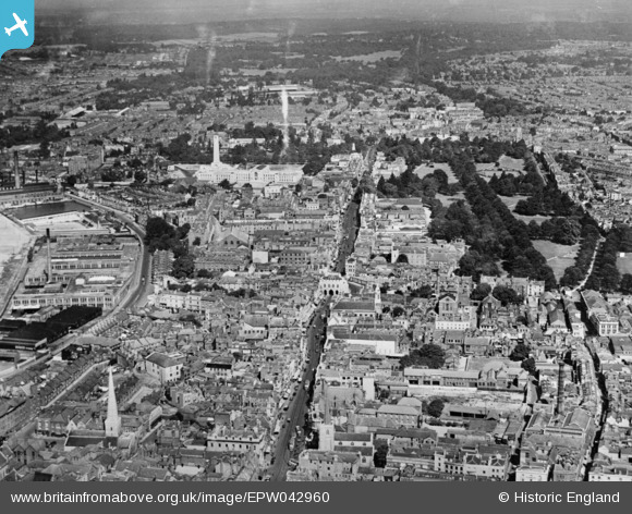
EPW042960 ENGLAND (1933). High Street, Above Bar Street and the city centre, Southampton, from the south, 1933. This image has been produced from a copy-negative.
© Copyright OpenStreetMap contributors and licensed by the OpenStreetMap Foundation. 2026. Cartography is licensed as CC BY-SA.
Nearby Images (3)
EPW042960

EPW000234

EPW020443

Details
| Title | [EPW042960] High Street, Above Bar Street and the city centre, Southampton, from the south, 1933. This image has been produced from a copy-negative. |
| Reference | EPW042960 |
| Date | August-1933 |
| Link | |
| Place name | SOUTHAMPTON |
| Parish | |
| District | |
| Country | ENGLAND |
| Easting / Northing | 442000, 111542 |
| Longitude / Latitude | -1.402657400564, 50.90127137231 |
| National Grid Reference | SU420115 |
Pins

jkm |
Wednesday 28th of April 2021 04:01:05 PM | |
|
jkm |
Wednesday 28th of April 2021 03:58:36 PM | |
|
jkm |
Wednesday 28th of April 2021 03:55:57 PM | |
|
jkm |
Wednesday 28th of April 2021 03:53:19 PM | |
 |
jkm |
Wednesday 28th of April 2021 03:51:15 PM |
|
jkm |
Wednesday 28th of April 2021 03:48:19 PM |
