
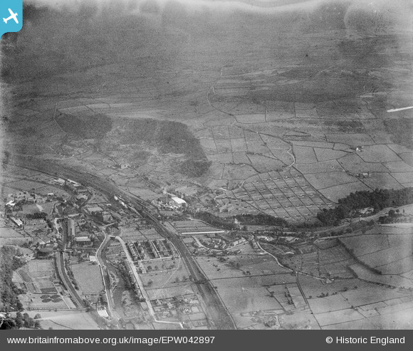
EPW042897 ENGLAND (1933). Thornber Brothers New House Poultry Farm and environs, Mytholmroyd, from the north-west, 1933
© Copyright OpenStreetMap contributors and licensed by the OpenStreetMap Foundation. 2026. Cartography is licensed as CC BY-SA.
Nearby Images (8)
EPW042897

EPW042896

EPW042895

EPW042892

EPW042893

EPW043090

EPW043083

EPW042894

Details
| Title | [EPW042897] Thornber Brothers New House Poultry Farm and environs, Mytholmroyd, from the north-west, 1933 |
| Reference | EPW042897 |
| Date | August-1933 |
| Link | |
| Place name | MYTHOLMROYD |
| Parish | HEBDEN ROYD |
| District | |
| Country | ENGLAND |
| Easting / Northing | 400905, 425942 |
| Longitude / Latitude | -1.9862810523446, 53.729651383596 |
| National Grid Reference | SE009259 |
Pins
Be the first to add a comment to this image!