
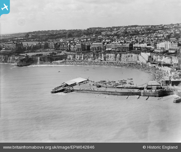
EPW042846 ENGLAND (1933). Viking Bay and the town, Broadstairs, from the north-east, 1933
© Copyright OpenStreetMap contributors and licensed by the OpenStreetMap Foundation. 2026. Cartography is licensed as CC BY-SA.
Nearby Images (24)
EPW042846

EPW000118

EAW024847

EAW024848

EPW000607

EPW035454

EPW000610

EPW000119

EPW042844

EPW000609

EPW035456

EAW015847

EPW009184

EPW035459

EPW035455

EPW000612

EAW024846

EAW015846

EPW009185

EPW000342

EAW024845

EAW015844

EPW000344

EAW015845

Details
| Title | [EPW042846] Viking Bay and the town, Broadstairs, from the north-east, 1933 |
| Reference | EPW042846 |
| Date | August-1933 |
| Link | |
| Place name | BROADSTAIRS |
| Parish | BROADSTAIRS AND ST. PETERS |
| District | |
| Country | ENGLAND |
| Easting / Northing | 639996, 167809 |
| Longitude / Latitude | 1.4476130475216, 51.358067207332 |
| National Grid Reference | TR400678 |
Pins
Be the first to add a comment to this image!