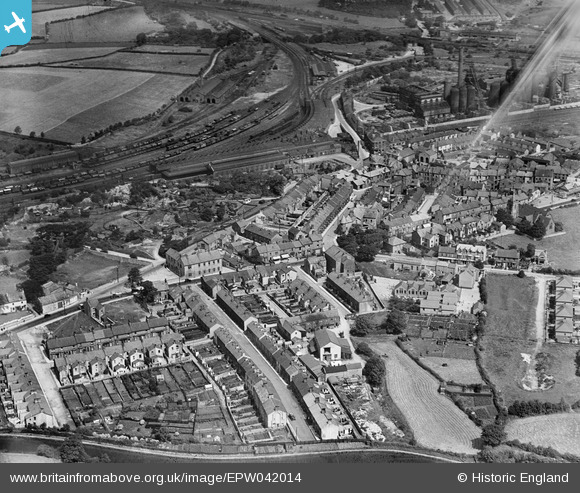
EPW042014 ENGLAND (1933). The town centre, Carnforth, 1933
© Copyright OpenStreetMap contributors and licensed by the OpenStreetMap Foundation. 2026. Cartography is licensed as CC BY-SA.
Nearby Images (5)
EPW042014

EPW042016

EPW029239

EPW042017

EPW042015

Details
| Title | [EPW042014] The town centre, Carnforth, 1933 |
| Reference | EPW042014 |
| Date | June-1933 |
| Link | |
| Place name | CARNFORTH |
| Parish | CARNFORTH |
| District | |
| Country | ENGLAND |
| Easting / Northing | 349759, 470452 |
| Longitude / Latitude | -2.7688871497024, 54.127288929072 |
| National Grid Reference | SD498705 |
Pins

John Wass |
Wednesday 29th of April 2015 09:03:04 PM | |
|
John Wass |
Wednesday 29th of April 2015 09:02:17 PM | |
|
John Wass |
Wednesday 29th of April 2015 09:01:34 PM | |
|
lesgilpin |
Wednesday 29th of April 2015 05:57:22 PM | |
|
lesgilpin |
Wednesday 29th of April 2015 05:56:45 PM | |
|
lesgilpin |
Wednesday 29th of April 2015 05:55:52 PM | |
|
wadey |
Saturday 28th of February 2015 04:23:55 PM | |
|
wadey |
Saturday 28th of February 2015 04:23:08 PM |