
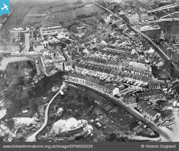
EPW029239 ENGLAND (1929). The town centre, Carnforth, 1929. This image has been produced from a copy-negative.
© Copyright OpenStreetMap contributors and licensed by the OpenStreetMap Foundation. 2026. Cartography is licensed as CC BY-SA.
Nearby Images (5)
EPW029239

EPW042016

EPW042014

EPW042017

EPW042015

Details
| Title | [EPW029239] The town centre, Carnforth, 1929. This image has been produced from a copy-negative. |
| Reference | EPW029239 |
| Date | September-1929 |
| Link | |
| Place name | CARNFORTH |
| Parish | CARNFORTH |
| District | |
| Country | ENGLAND |
| Easting / Northing | 349765, 470541 |
| Longitude / Latitude | -2.7688101442151, 54.128089421549 |
| National Grid Reference | SD498705 |
